Ralston Creek Hydrology Study


Project Background
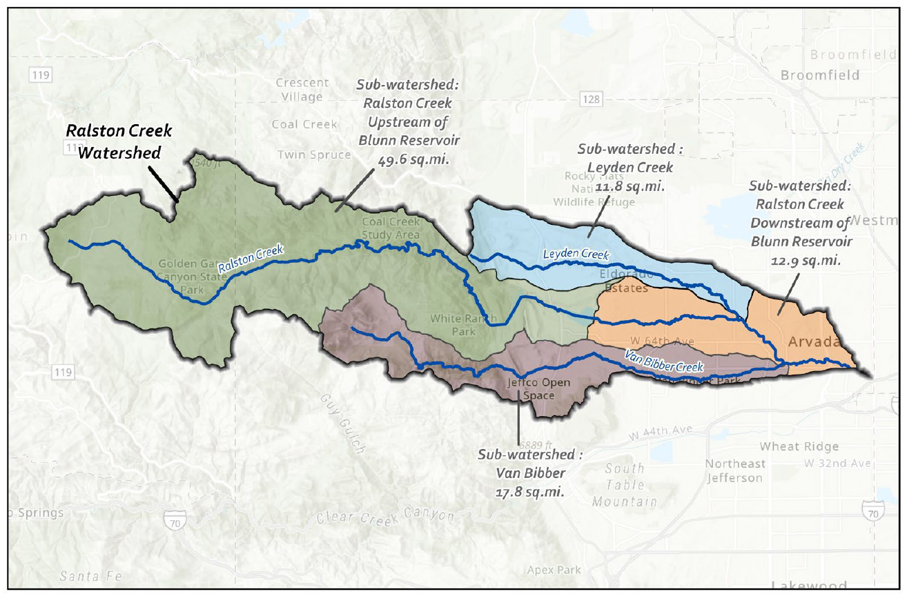
Ralston Creek is a left‑bank tributary to Clear Creek with a watershed spanning parts of Gilpin and Jefferson Counties and the City of Arvada. Major tributaries include Leyden Creek (north) and Van Bibber Creek (south). The study’s public purpose is to assess the baseline hydrologic conditions for this watershed, downstream of Blunn Reservoir.
The following tasks are a part of this overall study:
- Gather, organize and review existing hydrology data.
- Develop models for existing and future hydrologic conditions.
- Compare hydrologic model results with those of previous studies.
- Document findings in a baseline hydrology report.
Meetings
Meeting Schedule
Stay updated with the upcoming meeting schedule.
| Date | Time |
|---|---|
| TBD | TBD |
Site Images
.jpg)
.jpg)
.jpg)
.jpg)
.jpg)
.jpg)
.jpg)
.jpg)
.jpg)
.jpg)
Project Location
The Ralston Creek watershed extends west to the foothills and east through Arvada to the confluence with Clear Creek near Sheridan Blvd. Major tributaries include Van Bibber and Leyden Creeks.

Contact
Michael Baker International
Andrew Park-Friend, PE
Project Manager
303-929-1314

Mile High Flood District
Dan Hill, P.E., C.F.M.
Program Manager
303-455-6277